GIS stands for Geographic Information Systems. This is the type of software used by Emergency Victoria, the Powercor outage map, Victoria Land Channel, and Google Maps. This article introduces Quantum GIS, a free GIS application for Windows, Mac, Linux and Android.
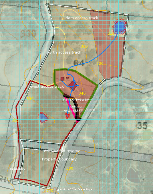
Quantum GIS software used to map 64 Mystic Drive. Fences, buildings, dams, etc, have been marked on separate layers. The base maps are from Land Channel and Google Maps.
What can I do with it?
You can:
- Import existing maps, for example, property boundaries from Land Channel
- Plot the location of particular features of your property.
- Measure distances without having to march around with a tape measure.
- Measure the area of an irregularly shaped paddock.
- Superimpose a contour map.
- Create layers for, for example, fences, water, buildings, geology, cropping.
The learning curve is a bit steep for the new user, but there is plenty of help available online, as with most open-source software. Here is an excellent Training Manual.
GIS software is a growing field of Information Technology and such skills are in demand. It has a multitude of applications in farming, forestry, mining, geography, epidemiology, conservation, defence and the social sciences.
Click here to download Quantum GIS.

Screenshot of Quantum GIS running on Linux